Discovering new Mayan 'Lost City' Localities in Mexico
"Previous research has shown that a large part of the present-day state of Campeche is a landscape that was transformed by its ancient inhabitants.""Now, this study shows that a little-known region was an urbanized landscape.""This density is comparable to that of Mayan sites such as Calakmul, Oxpemul and Becán."Adriana Velazquex Morlet, National Institute of Anthropology and History, Mexico"We have always been able to talk about the ancient Maya especially in the lowland regions because of their hieroglyphic texts, because they left us such interesting record[s].""What we are now able to do is match that information with their settlement and the population and what they were fighting over, what they were ruling over, what they were trading.""[The extensive data being collected will] allow us to tell better stories of the ancient Mayan people [linking what is already known with newly revealed hints on how ancient civilizations developed]."Tulane Professor Marcello Canuto"Scientists in ecology, forestry and civil engineering have been using lidar surveys to study some of these areas for totally separate purposes. So what if a lidar survey of this area already existed?""I was on something like page 16 of Google search and found a laser survey done by a Mexican organization for environmental monitoring.""It does not reveal a different perspective on Maya urbanism and landscapes, it actually shows us that the perspective we already had is pretty accurate. [The] number of buildings present in the entire data set is high enough to speak of genuinely high regional scale population entities.""[Archaeologists who know the region well were able to improve the team's analysis and provide] a really deep perspective on this region.""The nature of the ruins, the archeological buildings that were there — they were big and they were instantly recognizable as the kind of things that mark political capitals of the Maya Classic period.""That really puts an exclamation point behind the statement that, no, we have not found everything, and yes, there's a lot more to be discovered.""What I hope is that this encourages not only open data generally, but also collaboration between archeologists and environmental scientists going forward."Luke Auld-Thomas, instructor, Northern Arizona University
 |
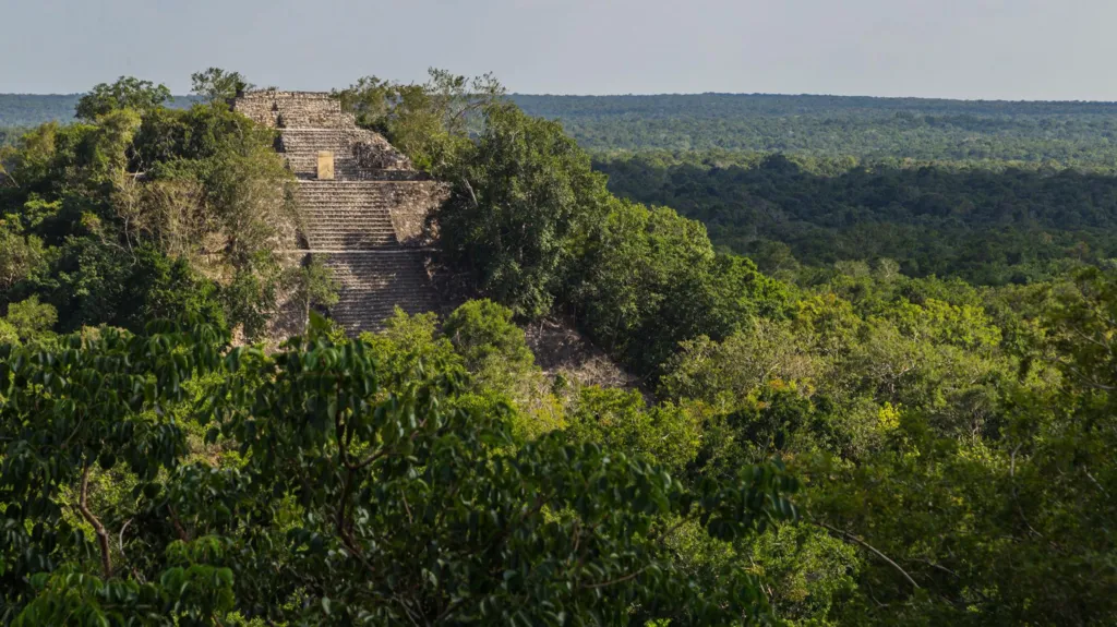
| There are no pictures of the city but it had pyramid temples similar to this one in nearby Calakmul Getty Images |
With the use of laser-sensing technology, archaeologists have been able to locate what they feel is an ancient Mayan city totally encroached upon and engulfed by jungle growth, in southern Mexico. The city has been named Valeriana by the researchers, as a geographic nod to a nearby lagoon named similarly. Thought of as another 'lost city', it is felt that the area may have been densely populated, as was the pre-Hispanic metropolis of Calakmul, in southern Yucatan peninsula.
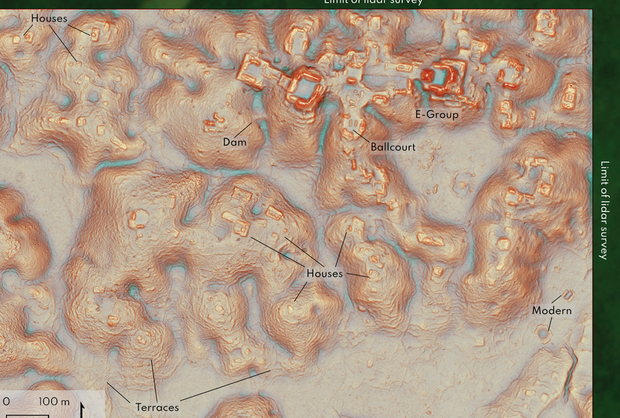
The study, published in the journal Antiquity, leads to the belief that the seemingly vacant, jungle-dense area between known Mayan sites may in their day have been very heavily populated. Roughly 6,479 structures were detected in LiDAR imagining in an area of about 122 square kilometres. The laser technique maps out landscapes with the use of thousands of laser pulses emanating from a plane, able to detect variations in topography not evident to the human eye.
Structures, including what appear to be temple platforms, ceremonial ball courts, housing platforms, agricultural terraces and what appears to be a dam are revealed by the images. Mexico's National Institute felt the structures could date to between 250 and 900 A.D. The settlement might have been in existence, however, a century earlier.
 |
Luke Auld-Thomas a graduate student at Tulane University in 2014, made note of strange formations in the jungle survey. He had been studying a 2013 LiDAR survey carried out for the purpose of measuring deforestation. Software was used to re-examine the 2013 survey as an alternative to using the very expensive LiDAR technique, when it occurred to Auld-Thomas that making second use of the survey could work just as well.
The research suggests that when Maya
civilizations collapsed around 800AD, part of the reason might have been because the region was too densely populated to survive problems encountered with the climate, and that often translates to too little potable water, impacting not only the irrigation of crops but water for everyday purposes in an urban setting. Inter-tribal war and the eventual arrival of Spanish conquistadors might well have contributed to the population's regional decline as well.
"It's suggesting that the landscape was just completely full of people at the onset of drought conditions and it didn't have a lot of flexibility left.""And so maybe the entire system basically unravelled as people moved farther away."Luke Auld-Thomas
 |
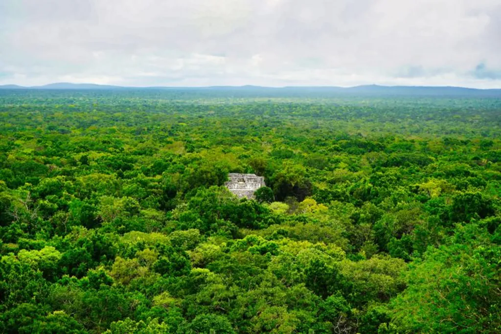
| Evidence of the ruins were found by a plane using laser remote sensing to map beneath the jungle canopy Getty Images |
Labels: Archaeology, LiDAR Technology, Mayan Civilization, Mexico, New Revelations

0 Comments:
Post a Comment
<< Home