Asia's Water Supply
"China is more prone to the adverse effects of climate change because China is vast, has diverse types of ecology and has relatively fragile natural conditions."
Du Xiangwan, chairman, National Expert Committee on Climate Change
"Floods in the Hexi Corridor are related to the torrential rains and precipitation from fronts. It's caused by climate change."
Wang Ninglian, glaciologist, Chinese Academy of Sciences
"The thing most sensitive to climate change is a glacier. In the 1970s, people thought glaciers were permanent. They didn't think that glaciers could recede. They thought this glacier [the Mengke Glacier] would endure. But then the climate began changing, and temperatures climbed."
Dr. Qin Xiang, Qilian Mountain research station
 |
The Tibet-Quinghai Plateau is experiencing permafrost disappearance, another hugely destabilizing geographic feature threatening the ongoing existence of plants and animals, along with infrastructure integrity, such as the railway that the Chinese government built to Lhasa, Tibet. What politics and hegemonic conflict leading to the triumph of the powerful has accomplished, nature now steps in to destroy.
All of these changes and what they portend for the future have had a chastening effect on Chinese authorities, leading the government to become more engaged in climate change negotiations internationally. Those future fears, augmented by the current situation of deadly urban air pollution brought on for the most part by industrial coal burning emitting carbon particulates generously in the atmosphere through giant smokestacks existing all over China's cities compromising the quality of urban life have sobered government.
A detailed scientific report on climate change was released in late fall of 2015 by China, predicting disastrous consequences to fall upon the future of the country's 1.4-billion population. Rising sea levels along the urbanized coastline, storm-causing floods across the country, and glacier erosion with over 80 percent of the Tibet-Qinghai Plateau losing its permafrost. A rise of temperature between 1.3 to 5 degrees Celsius by century's end heralding and ushering in all of the above.
Some 62 percent of Chinese cities have experienced floods between 2008 and 2010, some on multiple occasions. The surface area of glaciers on Mount Everest have shrunk almost 30 percent in the last 40 years, according to a separate report issued by Chinese scientists. An estimated 46,000 glaciers of the "Third Pole" region traditionally sustains 1.5-billion people living in ten countries, with waters flowing to the Mekong Delta of Vietnam, the hills of eastern Myanmar [Burma], and Bangladesh's southern plains.
Those glaciers, scattered across a five million square kilometres area on the north end of the Tibetan Plateau where the Qilian range crosses three provinces, towering to 5,500 meters with the Mengke Glacier representing a coverage area of almost 21 square kilometers, rapidly receding, causes ever more powerful and frequent floods. The Mengke Glacier retreated an average of 16.5 meters a year between 2005 and 2014, as compared to the period 1993 to 2005 when it retreated 8 meters annually.
The town of Shibaocheng, situated closest to the glacier, where 1,250 residents have traditionally grazed yaks, horses and sheep during the summer months, has been devastated. A storm initiated flooding that destroyed around 200 homes, killing close to 14,000 animals in 2012.
 | |
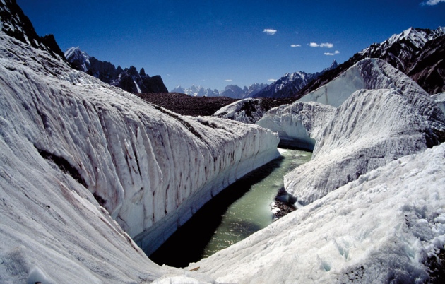
ANZENBERGER/URBAN GOLOB/EYEVINE The Baltoro Glacier in the Karakoram mountain range feeds the river Indus. 'Running 2,000 kilometres from east to west and comprising more than 60,000 square kilometres of ice, the Hindu Kush–Karakoram–Himalayan glaciers are a source of water for the quarter of the global population that lives in south Asia. Glaciers are natural stores and regulators of water supply to rivers, which, in turn, provide water for domestic and industrial consumption, energy generation and irrigation." Nature |
Labels: Climate Change, Environment, Nature

0 Comments:
Post a Comment
<< Home