Ruminations

Blog dedicated primarily to randomly selected news items; comments reflecting personal perceptions

Sunday, March 07, 2021

Awaiting the Eruption

"I have experienced earthquakes before but never so many in a row."
"It is very unusual to feel the Earth shake 24 hours a day for a whole week. It makes you feel very small and powerless against nature."
Auour Alfa Olafsdottir, Reykjavik resident
 
"We are used to it, it started one year ago."
"But it is much more now -- very unsettling. I'm not afraid but this is uncomfortable. I woke up twice last night because of [tremors]."
"There was a very big one when I went to sleep, and I woke up with one. It is difficult but you have to learn to live with it."
Pall Valur Bjornsson, deputy member of Parliament
 
"[The concern is that perhaps] this is the start of a major volcano-tectonic event at Bárðarbunga, which may further develop to the southwest. This is a concern because in the southwest there are fissures that have produced Iceland’s most voluminous lava flows, since the ice melted some 9,000 years ago."
"These fissures are up to 100 km long, and far to the southwest they can trigger eruptions at the Torfajökull volcano. Torfajökull happens to have an abundance of sticky magma that can erupt explosively and produce lots of fine ash. The last eruption, in 1477-1480, produced just two lava flows and minor explosions. But the one before, in about 874 AD, produced an explosive eruption plume that was carried over much of Iceland."
"Also to the southwest of Bárðarbunga lie the rivers which produce much of Iceland’s hydroelectric energy, and a fissure eruption in this area could cause big problems. Icelanders have long known about this possibility and have specific plans in place should this happen."
"I emphasize that we don’t know yet whether this is an isolated event or the start of a more prolonged and larger volcano-tectonic episode. It may be years before we know for certain. But at some time in the future there will be a major fissure eruption to the southwest of Bárðarbunga – we just don’t know when."
Dave McGarvie, volcanologist, The Open University
Bardarbunga caldera is about 10km wide in diameter. Iceland Geological Survey

 Iceland has been experiencing swarms of earthquakes over a period of months. So many that Iceland was hit with no fewer than 17,000 quakes in the past week alone, raising concerns over the potential for a volcanic eruption. In the southwestern region of Reykjanes peninsula Icelanders report having felt earthquakes of up to 5.6 magnitude on the Richter scale. The morning of February 24 saw the largest of the earthquakes rattle residents in the city of Reykjavik along with municipalities surrounding it.

It is an area holding roughly two-thirds of the entire population of Iceland. Magnitude 5.0 earthquakes struck on February 27 and March 1. Icelanders are familiar with the occasional earthquake rumbling beneath their feet. The land sits over a tectonic plate boundary situated between North America and Eurasia where the plates continuously slide apart along the mid-Atlantic ridge. Most of the seismic activity goes unnoticed by the residents, however -- only noted as it is picked up by sensitive scientific equipment.
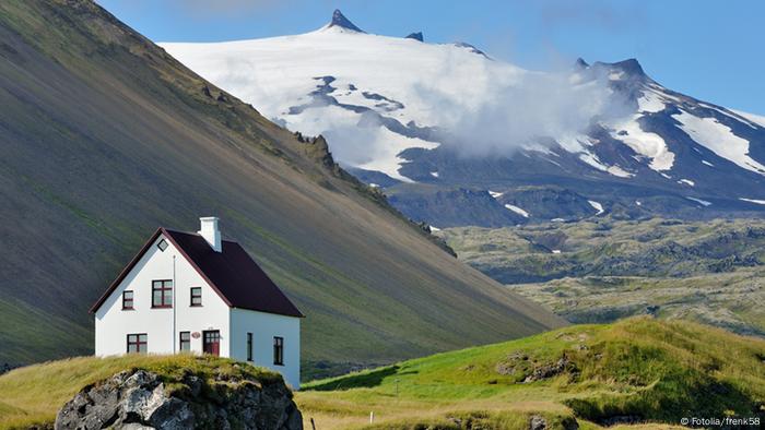
 
A home in Iceland with a volcano in the background
 
In the fishing village of Grindavik some residents claim to have felt a constant ground tremor. Not much in the way of physical damage has occurred; a number of cracks in the road; rockfalls on slopes near the epicentre, but residents are well aware that the severity of the quakes and a resulting volcanic eruption could escalate the situation. At the Icelandic Meteorological Office, Elisabet Palmadottir specializing in natural hazards feels an earthquake of larger magnitude could soon occur and that causes concern.
 
"In this particular area, where we've seen activity in the past week, we could experience a magnitude 6.0 earthquake. But we could have a 6.5 to the east of the area, east of the Kleifarvatn Lake", she advised. The region has multiple volcanoes and meteorologists know that the constant rumbling could be a warning of an upcoming eruption. "Such signs are often detected in the run-up to eruptions -- it has not been confirmed that an eruption has begun. Further analysis is underway", stated the Icelandic Meteorological Office. 

Some things are known of a certainty; that these rumblings, their endurance and threat presage the potential for a volcanic eruption. Which could occur without warning, at any time. Or not, though it hardly seems likely given their persistence and the strength that some of the tremors attain.
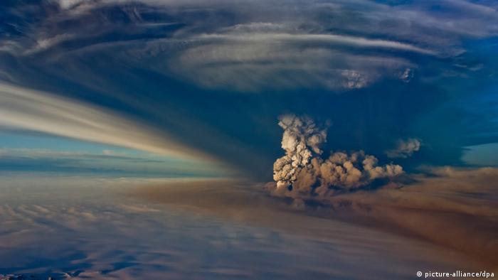
The last eruption of Grimsvotn canceled the country's main airport


Labels: , , ,

Sunday, November 12, 2017

Iceland's Future Forests

"At the time of human settlement almost 1150 years ago, birch forest and woodland covered 25-40% of Iceland's land area. The relatively tall (to 15 m) birch forests of sheltered valleys graded to birch and willow scrub toward the coast, on exposed sites and in wetland areas and to willow tundra at high elevations."
"As in agrarian societies everywhere, the settlers began by cutting down the forests to create fields and grazing land. Sheep were important as a source of wool from the outset, but by about 1300 they had become a staple source of food for Icelanders as well"

"An important contributor to Iceland's mitigation policy is planting trees."
"It's a big discussion here."
"[Roughly 40 percent of the country is desert] but there's plenty of rainfall -- we call it 'wet desert'."
Gudmundur Halidorsson, Soil Conservation Service of Iceland

"The aim now is that in the next fifty years we might go up to five percent [coverage in forest growth in barren Iceland's environment]."
But at the speed we're at now, it would take 150 years to do that."
Saemundur Thorvaldsson, Iceland government forester
Iceland has a spectacular and most unfortunate lack of trees. It is a northern, volcanic island; a group of islands to be more precise, the largest, main island on which the capital Reykjavik stands. It suffers from severe soil erosion. Unsurprising, given the lack of forests in the country since any kind of vegetation struggles to set down roots and a lasting presence. Raising livestock is impracticable under the circumstances; where and what would they graze? Similarly farming presents its own dilemma with the loose soil swept away by wind of which Iceland has an abundance.

The population of Iceland is about 350,000 people living in a small geography, estimated at 39,000 square miles. A volcanic eruption occurs on average every four years. Quaintly in this most peculiar of environments, which is said to be the last on Earth to have been inhabited by settlers, there is a popular and firm belief in the presence of elves.  The native language spoken is that of ancient Norse. It is outstanding as a whale-watching venue, earning the country tourist dollars for that very purpose. Unsurprisingly for an isolated population, more films are viewed in Iceland than anywhere else in the world.

The country uses geothermal energy and hydro power to solve its energy needs, yet still faces high per capita emissions of greenhouse gases, as a result of transportation and heavy industries such as aluminum smelting. That there is an absence of trees to perform the vital function of absorbing atmospheric carbon dioxide within their trunks, roots and tissues spells a huge dilemma for a country anxious to meet climate change goals through offsetting its industrial emissions..

There are no trees -- at least there is a huge dearth of trees -- because a thousand years ago Viking settlers axed the forests that had once been hosted on 24 percent of the countryside. Not that Iceland hasn't been trying to regenerate forests. "It's definitely a struggle", explained Jon Asgeir Jonsson who has been planting trees in the barren landscapes of his country, with the understanding that the return of forests would go far to improve and stabilize the harsh soils reflecting desertification resulting from deforestation.
mbl.is/Eggert Jóhannesson
At the very least, three million trees have been planted in the recent past in a landscape that doesn't lend itself to nourishing them to swift maturity. An estimated one percent of Iceland was covered in forest at the turn of the 20th Century at a time when the country viewed reforestation as a priority. That pitiable percentage has barely budged, since then. Mr. Jonsson, a forester working for the private Icelandic Forestry Association, plants saplings alongside volunteers from local forestry groups. "We have gained maybe half a percent in the last century", he states gloomily.

Volcanic ash and rock spewed by ongoing eruptions contributes to severe soil erosion. Loose soil and strong winds make for sandstorms further damaging the land. Sandstorms fierce enough to blast the paint off cars. Thick layers of volcanic material leave ash rich in nutrients, but representing fragile soil unable to hold water, which shifts about with the blowing wind. Mr. Thorvaldsson considers the tree species to plant in Iceland is birch, reflecting the original species, 30 percent dominant when the land was settled.

Birch's ability to tolerate poor soil provides shelter for other species as it grows. Sitka spruce, lodgepole pine, black cottonwood -- all originated in Alaska, now growing as well in Iceland as saplings in greenhouses. Trees imported from elsewhere are prohibited by law. These trees grow quicker than birch but even they grow slowly. In comparison southeast Alaska sees its trees reaching three times the height of spruces planted in the 1940s, now reaching 15 meters in height.
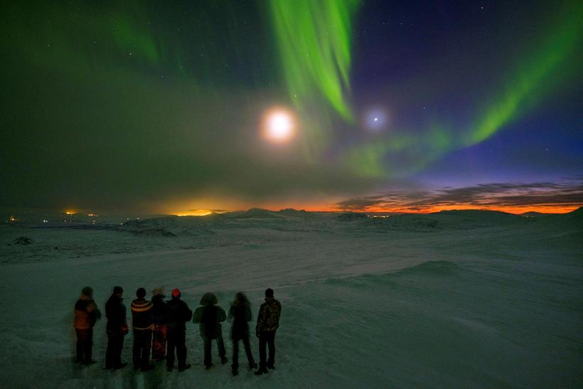
The northern lights are a common source for complaints and ...
Viewing the Northern Lights   --  mbl.is/Golli

Labels: , , ,

Wednesday, November 12, 2014

Living With Shock and Awe

"On regular days the kids go out to play to take in the fresh air, but that's not really possible or safe under the current conditions."
"Personally, I can feel the contamination a little. Breathing is a little uncomfortable, and it's uncomfortable staying outside when the contamination comes in over our town."
Agusta Palsdottir, manager, Graenuvellir kindergarten, Husavik, north Iceland

"There's exactly nothing you can do, aside from going inside."
"People that are more sensitive than others need to avoid physical exertion outside and try to stay inside and warm up their houses to prevent the gas from getting inside."
Kristjan Thor Magnusson, mayor, Northurthing municipality

"Which town is affected depends only on weather and winds."
"There's still a chance that the eruption in Holuhraun will pose a risk to international air travel. "
"Although there's quite a bit of activity in the crater of Bardarbunga volcano, the activity does seem to be moving northeast, away from the ice cap."
"Wind and rain are the best thing to happen for Icelanders while the eruption continues. Iceland usually has plenty of that."
Bergthora S. Thorbjarnardottir, geophysicist, Icelandic Met Office
The Holuhraun eruption fissure and ash.
The eruption in Holuhraun. Photo: Geir Ólafsson.

Since November 7th, some 200 earthquakes have rocked the area surrounding the eruption site around the Holuhraun lava field near the Bardarbunga volcano in northern Iceland. The largest of those quakes measured about 5.2 magnitude and Iceland's Civil Protection Agency warned that gas pollution was expected in the western part of the country, as a result. When the volcano first began erupting in August it was thought that air traffic would be impacted as it had been in 2010.

At that time, the eruption of the Eyjafjallajokull volcano under its ice cap threw a column of ash fully nine kilometres into the sky, an event that led to the closure of airspace across Europe for a six-day period. Carriers responded by having to cancel over 100,000 flights since the spewing ash constitutes a danger as the particles, like glass in the air, is capable of damaging jet engines.

When the volcano began its tell-tale rumbling a fissure 300 metres long was the site of the eruption. An eruption right under the glacier covering the volcano could create an explosion spewing ash into the air at a dangerous level, but the fissures has been moving northeast, and away from the threatened ice.  This eruption, while not the largest, is comparable to the 1783 Lakagigar blowout which covered 600 square kilometres in Lava, the event seven to eight months in duration.

Sulfur dioxide pollution visible over Reykjavík
Haze from the pollution over Reykjavík on October 8. Photo: Zoë Robert.

At the present time with the current three-month-long eruption sulphur-dioxide gas is spewing from the lave field near the volcano with no signals that it will soon come to an end. 70 square kilometres have so far been covered with red-hot lava. Icelanders wait and hope. as they monitor the gas clouds drifting across the island, produced by the volcanic activity. Icelanders are not observing a new phenomena.

They have learned to live with their island covered with volcanoes, and to harness their power. The late 1700s eruption is known to have been the cause of a famine that killed 25 percent of the population, descendants of Viking settlers. The government issues warnings on health risks, that exposure to sulphur dioxide can cause eye, throat and lung irritation, while high-levels can lead to breathing difficulties, with children the most vulnerable.
A radar image of the new lava
Photo: Institute of Earth Sciences.   Lava Flow

Iceland is the mysterious land of strange creatures living in peculiar rock formations. Not only is the geology of the country amazing to behold, but the creatures living within that geology are held in great respect by Icelanders, from the elves and the hidden people to the trolls that inhabit the hidden mysteries of the island. They are held in great respect and reverence, for it would never do to give grave insult to the creatures of Iceland. One can never know what the consequences may be. It is not impossible that the volcano now spewing its poison gas and lava has taken umbrage on behalf of its elves having reported a slight, however inadvertent.
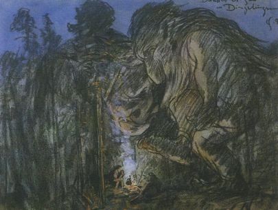
Icelandic Trolls

Labels: ,

Tuesday, August 26, 2014

Iceland volcano: Bardarbunga hit by 5.7 earthquake

BBC News online -- 26 August 2014
Local authorities on patrol in the area close to area hit by recent powerful earthquakes in Iceland - 24 August 2014 Local authorities have closed roads leading to the area and evacuated several hundred people

Related Stories

Iceland's Bardarbunga volcano was hit by a magnitude 5.7 earthquake on Tuesday morning, the largest since tremors began in the area last week.
The country's Met Office said despite the shock - the fourth magnitude five quake in 48 hours - there is still no sign of a volcanic eruption.
On Sunday, Iceland lowered the aviation risk to its second highest level.
Iceland's Eyjafjallajokull volcano erupted in 2010, producing ash that disrupted air travel across Europe.
Bardarbunga is in a different range to Eyjafjallajokull, but the intense seismic activity has raised fears that an eruption could cause similar travel chaos.
Map of Iceland showing the Bardarbunga volcano
No surface movement "There was one event during the night. It was a magnitude 5.7 [earthquake], the largest in this series," Palni Erlendsson, a geologist at Iceland's Met Office told Reuters news agency.
The activity was still deep below ground, Mr Erlendsson said, adding there had been no signs of movement close to the surface.
"We still can't say whether [the activity] will cease, continue like this for a while or erupt. It's impossible to say," he said.
An image from a flight over the Vatnajokull glacier that sits on top of the large volcanic range - 23 August 2014 The Vatnajokull glacier sits on top of the volcanic range. There are fears an eruption could cause flooding
The magnitude five earthquakes are the strongest to hit the Bardarbunga region since 1996.
The Met Office said the latest large tremor occurred at 01:26 GMT to the north of Bardarbunga, 6km (3.7 miles) below the surface, near the rim of Dyngjujokull, another nearby volcano.
Bardarbunga and Dyngjujokull are part of a large volcano system hidden beneath the 500m-thick (1,600ft) Vatnajokull glacier in central Iceland.
The region, more than 300km (190 miles) from the capital Reykjavik, has no permanent residents but sits within a national park popular with tourists. Several hundred people have been evacuated from the area.
Authorities have previously warned that any eruption could result in flooding north of the glacier.
But experts said the activity was migrating north, with the tip of the movement already 10km (6 miles) outside the glacier.
Scientists believe the earthquakes are a result of magma flowing out from beneath the volcano, causing a change in pressure.
This movement could stop, reducing the seismic activity, or the magma could reach the surface and lead to an eruption.
On Sunday, Iceland lowered its level of alert to the aviation industry from red, warning of an imminent eruption, to its second-highest level, orange.
Airspace over the site has been closed, but all Icelandic airports currently remain open, authorities say.
The Eyjafjallajokull eruption in April 2010 caused the largest closure of European airspace since World War Two, with losses estimated at between 1.5bn and 2.5bn euros (£1.3bn-2.2bn).

Labels: , ,

 
()() Follow @rheytah Tweet