Ruminations

Blog dedicated primarily to randomly selected news items; comments reflecting personal perceptions

Monday, September 24, 2018

Surviving Natural Disasters

"I guarantee you, I can say this without a doubt, my husband saved my life and my son's life."
"We didn't get water inside the house, but at one point we were completely surrounded."
"I try to be positive, but it's getting harder and harder. I really feel like we're being tested. I'm a God-fearing woman but I'm confused right now."
"I have never heard my husband yell in that manner 'Get down here right now'!"
"A friend of mine was joking when she said, 'I will never live beside you'. This is following us. I said to our builder, I feel like this is my fault."
Nicole Lowden, Ottawa paramedic
Brian and Nicole Lowden’s house was destroyed by a tornado on Thomas Dolan Parkway in Dunrobin, September 23, 2018. Jean Levac / Postmedia News
"This is definitely not a short-term fix here. We're looking at weeks and months [of work to normalize the community struck by a category 3 tornado on Friday]."
"Dunrobin will bounce back and it will be rebuilt and we'll be stronger for it."
"There's a lot of heartache, but it's expressed in hope."
Greg Patacairk, president, Dunrobin Community Association
Last Friday was a really peculiar day weatherwise in Ottawa, Canada's capital city. The area, in the Ottawa Valley, is prone to freakish weather conditions, but this time the conditions were quite extraordinary. A year ago, areas of the city and across into the province next to Ontario, Quebec, there was flooding from incessant heavy spring rain. Built on Leda clay, susceptible to 'melting' when completely suffused with rain, there had been some mudslides, and the Ottawa River dividing the provinces, flooded.

Back then, the Lowden family living in the community of Constance Bay on Bayview Drive, just managed, with the help of sandbags and pumping the water out of their basement, to keep the floodwaters out of the house they had lived in for twenty years. They decided, however, to sell the house and move out of the area. Then, they planned to build a new house elsewhere in the community. Just as their old house sold, their daughter, age 21, was diagnosed with Stage 2 lymphoma. After chemotherapy treatment she is on the road to recovery.
Brian Lowden sits on an overturned boat in his backyard among debris left by the tornado that touched down in Dunrobin on Sept. 21. (Justin Tang/Canadian Press)
They have been living in a rented house in the community of Dunrobin, and disaster followed them to that location when on Friday, after a steaming, humid day of 29C with forceful winds prevailing and weather warnings of violent thunderstorms, one of those thunderstorms struck at 4:30 p.m., sending daggers of lightning from sky to ground. So much, so normal, for the Ottawa area. What was abnormal was the tornado that struck at five in the afternoon of the last day of summer. It swept through the community, ripping up trees, tumbling cars, tearing the roofs off homes and buildings.

The tornado broke hydro poles as though they were matchsticks, a quarter-of-a-million residents were without power and have been for days. And about 60 houses were completely destroyed. The Lowden family's rented house among them. Their adult son, tired after work, had arrived home to collapse on his bed upstairs. Nicole's husband Brian, a volunteer firefighter who had been on duty at a nearby fall fair, came home early in response to the severe weather warning. Nicole was upstairs closing windows against the wind and rain, when she heard her husband shout out from downstairs.

He bounded up the stairs to drag their son Daniel out of bed, and hauled her with them down the stairs to huddle in the kitchen beside the refrigerator in the basement-less house.  "I'm telling you, that's the only part of the house that is untouched", she later said. Daniel went in frantic search of their six-pound blind dog, Lola, as windows were breaking all around them, and lumber was splintering and flying through the air, and the roof flew off the house. They could look outside to see the house next door utterly gone, nothing but the foundation left.

They had no insurance on the house contents and nothing is salvageable. Escorted by firemen and other volunteers on Sunday the evacuated residents of Dunrobin were allowed to return to their homes -- what was left of them -- to look for items and keepsakes. And the Lowden family is looking for alternate rental accommodation, awaiting the completion of their new home whose construction is meant to be complete by next spring.

A firefighter hands Alex Carlson his laptop, which was recovered from the wreckage of his Dunrobin home. A volunteer firefighter for the local fire department, Carlson might have been called to the scene of his own home's destruction had he not been out of the city at the time. (Justin Tang/The Canadian Press)

Labels: , , , ,

Friday, September 08, 2017

Indifferent Nature, Terrorized Humans

"The heaviest rainfall events have become heavier and more frequent, and the amount of rain falling on the heaviest rain days has also increased."
"The mechanism driving these changes [is hotter air stemming from] human-caused warming." 
National Climate Assessment, U.S.

"I've lost everything. My home has been torn apart. Everything is gone. This is not my first hurricane but it's the worst I've ever experienced."
"The kitchen came apart, then the roof came off, and we had to spend the night outside in the wilderness. We called out but no one heard us. We need to get off this island. Everyone is homeless, we don't have anything to ride out the next storm."
Gloria Cethaf, mother of six, Barbuda

"It was devastating. I was at my parents' house and the back door blew in, so we ran to the community centre, which was a shelter, and it was packed."
"Then the community centre was destroyed so I went to my friend's house but it was completely gone. My business, my bakery, gone. It's too much to handle."
Jacqueline Beazer, Barbuda

"It was like a horror movie. People were running from house to house, and we had cars flying over our heads."
"We had 40-foot containers flying left and right, people were tying themselves to their roofs with ropes to keep them down."
Barbudan woman
AFP/Getty Images
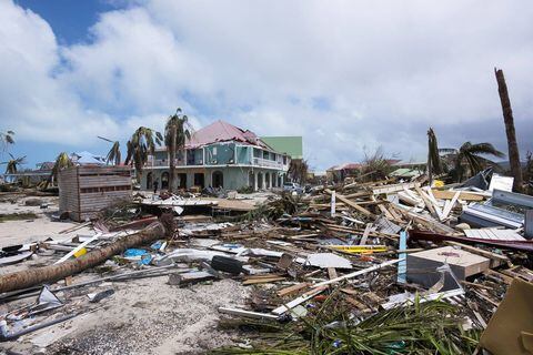
A photo taken on September 7, 2017 shows damage in Orient Bay on the French Caribbean island of Saint Martin, after the passage of Hurricane Irma.  LIONEL CHAMOISEAU/AFP/Getty Images

And now it is Florida's turn. Evacuation orders have gone out to residents to leave, after many had barricaded their homes with everything they could get to safeguard their property against the coming hurricane with its impossible-to-imagine wind force, the most powerful ever recorded. Imagine an anthill, well established, large and rounded, its inhabitants busy with their life-work and suddenly something plows into it, and the ants in instant reaction hysterically scurry here and there, attempting to escape life-threatening danger; an escape too late for many of them.

All of Savannah, Georgia has been evacuated, awaiting the hurricane's full force, possibly at the 4 level when it hits full-blown, down by one-degree of deadly force from what those in Barbuda experienced. Texas is still attempting to find itself after its relatively more feeble wind force and pounding rain with Hurricane Harvey. The state had no laws in force to control where and how buildings were placed, no municipal building codes. The highways of cement do not absorb excessive water; nor does paved-over arable land converted to homes and businesses.

Nations like the Netherlands, Britain, France and the U.S. with national interests in the Caribbean have sent ships and planes with emergency workers, food, water, troops and medicine. Paltry, but life-affirming. Paltry in the sense that what is being offered barely covers the depth and breadth of need in vulnerable areas destroyed by the prodigious force of nature that assailed them. The Florida Keys and South Florida are exiting the area, along with parts of metropolitan Miami; a lot of people on the move, desperately so.
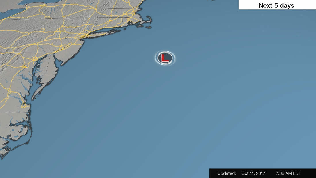
Hurricane Irma forecast track

In the Gulf of Mexico the surface temperature of the water last winter was surprisingly warm. Warm seas result in increased moisture evaporating into the atmosphere and this in turn incites the presence of more ferocious storms, carrying an increased load of moisture; what goes up must come down. Climate change is presenting the world with droughts, famines and deadly heat waves, and enabling the spread of disease carried by vectors with an increasing range.

The threats to international safety and security caused by terrorist groups disables society to a degree where destabilization is balanced by increased vigilance and time-consuming steps to counteract the potential of attacks. Nature's assumptive agency with her various elements which in unleashed fury swiftly destroys far more than human agency can even imagine save for the use of atomic weaponry, is a cause of human terror for in these extreme events there is little-to-nothing that humans can do to protect themselves.

Heavier rain interacts with higher sea levels increasing flooding -- and Houston's lack of foresight in enacting zoning laws permitting building to ensue in vulnerable areas complicates matters enormously. We see Houston's perilous decision-making reflected in areas throughout the world through inattention to vitiating nature's unpredictability in visiting chaos and cataclysmic events on an unprepared public. And we never seem to learn from such experiences.

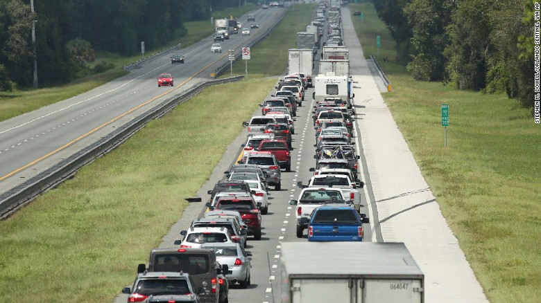
Traffic rolls at a crawl on the northbound lanes of the Florida's Turnpike near I-75 in Wildwood.
Traffic rolls at a crawl on the northbound lanes of the Florida's Turnpike near I-75 in Wildwood   CNN


Labels: , , ,

Friday, July 14, 2017

Signalling Early Disaster Warning : ICARUS Initative (International Cooperation for Aninal Research)

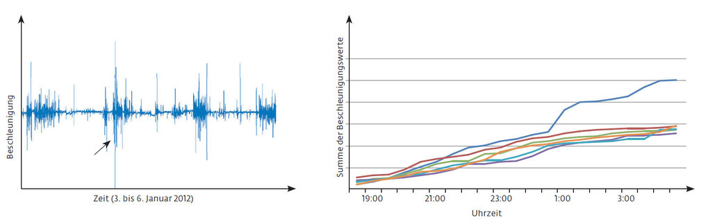
"Wow, it really looks as though something is there. The animals predicted the major volcanic eruptions during these two years between four to six hours before."
"At night, the animals woke up and nervously walked around, and in daytime, they moved to a safe area."
"If it's just one animal alone from one farm, we wouldn't be able to see a signal. But if you take it all together, the synergies, the synthesis of these sensing systems, that's really what seems to give the signal."
Martin Wikeiski, director, Max Planck Institute for Ornithology, Radolfzell, Germany


Florindo Angeli, right, and his son removing a tag from a sheep at their farm in Pieve Torina, Italy, in April. Animals at the farm had worn the solar-powered tags for months as part of an experiment to monitor their behavior before earthquakes. Credit Nadia Shira Cohen for The New York Times
There are any number of sensitive, technologically-advanced early warning systems to alert scientists, civil authorities and federal agencies to the imminence of a natural disaster; a volcanic eruption, an earthquake, a tsunami, often allowing time to alert people how they must react; move to higher ground, evacuate an area, take shelter, to minimize the dread effects of natural events that wreak untold damage to natural areas and to man-made structures, threatening lives.

There are networks of interconnected measurement stations located on the ocean floor, in remote dry land areas, computer-monitored constantly by technicians skilled in interpreting data who then immediately alert others up the chain of command that a reaction is required to safeguard lives. Farmers, and those living in close proximity to animals of all kinds have observed over the ages that another early warning alert system exists, and that it is expressed by alerted and consequently nervous-to-consequences animals.

Professor Wikelski, in the wake of a series of earthquakes striking Italy last year, arrived there with the express purpose of observing and studying whether animals really are capable of anticipating natural disasters through a medium of awareness not shared by humans. Their sensitivity to signals they pick up that inform them that untoward occurrences are on the cusp of threatening the stability of the earth causes them deep concern, and that concern has been transmitted to human recognition for thousands of years.

This scientist and his colleague proceeded to tag animals on a farm in the Marches region of central Italy for the purpose of monitoring their behaviour expecting that if they did exhibit behavioral changes consitently prefacing an earthquake, another reliable phenomena based on animal sensitivities could be used as an early warning system, the consequence of which could be saved lives. In other words, this scientist set out to prove to his own satisfaction what people living close to animals have themselves experienced uncountable times in the past.

A series of earthquakes, starting in August and followed by additional heavy tremblors in the months that followed were accompanied by thousands of aftershocks, burdening Italy with an estimated $26-billion in damage, where thousands of people became homeless and over 300 died. The conclusion of Dr. Wikelski's experiment became evident when the data crunched by computer software verified that animals moved in a consistent manner prior to the series of quakes.

Mr. Wikelski and research project manager Uschi Muller came across the Angeli farm in Pieve Torina. The farm operated a retail outlet, selling cheese they produce from sheep and cows. When the researchers viewed the shop at the farm they realized that "Everything was broken. You could see their livelihood was gone." The family permitted Dr. Wikelski to tag their farm animals; a rabbit, sheep, cows, turkeys, chickens and dogs, using small, sophisticated solar-powered sensors.
Every movement produced by the animals was recorded and measured for their reactions, along with relevant magnetic direction, speed, altitude, temperature, humidity, acceleration and location. Professor Wikelski understood that different species could react variously to environmental changes alerting their senses. Taking them all together, they could "form a collective sensing system", he felt, and on a global level that type of collective could be thought of as "the internet of animals".

The expectation of a conclusion coming out of the collected data was that once it is compared with the data from the area collected by means of mechanical technology, distinctive behavior in the animals before, during and following an earthquake will be realized, that the animals' reactive behaviour in hours leading up to an earthquake might be taken into account for its usefulness as an early warning system, giving people time and opportunity before disaster struck, to evacuate.

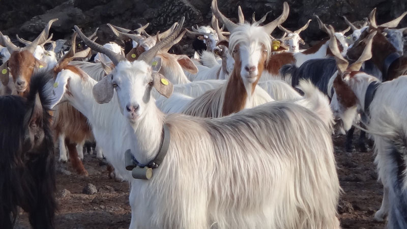
Animals can sense natural disasters: Goats on Mount Etna in Sicily, for example, become anxious before major eruptions. Their movement profiles may provide warning of imminent eruptions in future.

Labels: , , ,

Sunday, July 19, 2015

Losing Forest to Wildfires

"This is almost a record-breaking season for us. Crews are on their third and fourth deployment already and we're only halfway through. We've had them stay for 18 days [instead of the usual 15]."
"The first two deployments, everybody has got a lot of juice But some of these guys are on their third and fourth deployments, back to back to back, and that's unusual. As we go further into the season, fatigue is a factor."
"In Alberta, we've got an excellent safety record. We just don't put people in that [life-threatening] position. I'm proud of the record we have in Alberta."
Doug Smith, area firefighting commander

"I'd say that [rappelling down from a helicopter into stands of burning timber] sends goosebumps up your arm every time."
"We go through that in every recruit [training] camp. We give them the story of the fallen firefighters. We pay our tributes to them."
Jamie Parker, rappel team member, Calgary
“Jasper
A wildfire rises over a hill in Jasper National Park on July 9, 2015. Edmonton Journal
"The Canadian safety record when it comes to wildland fire suppression is pretty remarkable. I don't believe we'll ever get it down to zero fatalities. One, two, three a year. I hate to say it, that's probably reality."
"We've had very few entrapments. We've had drownings, where firefighters are camped out on a line and they get chased into a lake by the fire. There are vehicle accidents. Normal things."
"We often look for technological fixes, but it still comes back to having good people on the ground -- crew bosses who know what they're doing and keep rookie firefighters out of harm's way. I don't think that's going to change."
Marty Alexander, retired wildland fire behaviour expert, Sherwood Park, Alberta

"There but for the grace of God. Everyone in our planes is a consenting adult and they know what they're getting into. And safety of the operation is paramount. But you still shudder at the thought [fire fighting amphibious water tankers crashing]."
"We have to make sure our crews are properly rested We have spare pilots so guys can get days off to decompress."
Paul Lane, vice-president, Air Spray, aerial firefighting company
“Air
A Lockheed Electra, operated by Air Spray, dumps a load of fire retardant. Edmonton Journal

The summer of 2015 has been hot, dry and demanding in most of Western Canada. From mid-week last week 1,422 fires had been reported in the province of Alberta itself alone. The result has been 485,838 hectares of land scorched, much above normal, with five-year averages at mid-summer standing at an average of 905 fires involving 254,527 hectares.

The demand for firefighters' services battling the wildfires has been so intense that longer rotations and extended shifts have resulted on the fire line. Time away from fighting the fires to allow fire fighting personnel to recoup some strength has been cut as well. Firefighters from Mexico, New Zealand, Australia, the United States, Ontario, Prince Edward Island, Nova Scotia, Newfoundland and New Brunswick have responded to the urgent appeal to give aid.

Across Alberta alone roughly 1,500 personnel have been deployed, representing 500 firefighters from the province, with another 280 contract workers, topped off by the imported and emergency personnel. But they've been worked so hard there is always the opportunity for tired firefighters to make errors in judgement; safety is always front of mind, but fatigue and stress can deleteriously impact the best of intentions.

Not just anyone becomes a firefighter. To enter the government training program people must be able to pass rigorous physical and mental fitness tests. The training program itself, depending on particular duties involved, lasts between eight days to a month, with a focus on safety, respecting all the programs. Some jobs carry more risks than others; some jobs carry risks that are different than those encountered on other jobs; it varies.

The rappel teams are comprised of some of the most highly trained firefighters who drop from helicopters into areas that vehicles cannot reach. Their work consists mostly of clearing space to enable larger craft to land and their four- or eight-person Helitack crews to emerge, along with related equipment. The initial firefighting tasks are addressed under the agency of these first crews, fighting new fires, digging fire guards, cleaning out potential fuel sources such as fallen trees, and dousing hot spots with hoses, bags and pumps.

Bulldozers are used to clear the forest floor, scraping down to the mineral level. Other crews come in afterward to perform the mop-up finishing work. On the line, firefighters establish LACES [lookouts, anchor points, communications, escape routes, safety zones] before focusing their attention on  fighting fires, A carefully observed watch protocol for any signs of unsafe conditions is a vital part of the job, entailing a high degree of vigilance.

At the provincial firefighting training centre in Hinton, 19 memorials to fallen wildland firefighters have been erected. One of which memorializes Harro van Bockel, a rappel team member who, along with a fellow crew member was dragged while suspended below a moving helicopter, into a stand of burning timber. Mr. van Bockel died, the other team member survived his serious injuries.

“Gear
Two fire-suppression-related deaths have occurred this season in Canada. When tree-faller John Joe Phare, 60, was struck by a tree in British Columbia he became the first fatality. Pilot William Hilts, 38, died near Cold Lake in the crash of a Fire Boss amphibious water tanker in May, owned by Conair Aerial Firefighting. A second Conair Fire Boss sank in British Columbia in early July, with the pilot surviving the  episode.

Air Spray scouts for smoke in their observation aircraft and drops fire retardant from the tanks of the Lockheed Electras under contract to the government of Alberta. Most pilots have already logged twice as many hours as is considered normal for this time of year. "This year, we're looking at the issue of running our equipment extremely hard because we're fighting that much fire. That's why we're buying more aircraft and gearing up.

"This problem isn't going to be going away this year or next", explains vice-president of Air Spray, Paul Lane. "There is a long-term upward trend and we'll need more equipment to meet demand."

Labels: , , , , ,

Saturday, December 27, 2014

Waiting For The "Big One"

"In some places there will be maybe 20 minutes before the wave hits."
"The gold standard is what was done in Oregon and that's what we should aim for."
"There is a very clearly defined set of tsunami problems that need to be solved."
Garry Rogers, senior research scientist, Pacific Geoscience Centre, Victoria

"There would be widespread damage, including thousands of injuries and fatalities and the destruction of hundreds of buildings."
"Overall the province [British Columbia] is still at a significant risk if a catastrophic earthquake were to occur today."
British Columbia auditor general report

The dreadful earthquake and following tsunami of horrendous proportions, took the lives of a quarter of a million people in fourteen countries on what was for those countries a truly fateful day in 2004 when Indonesia [200,000 dead, 37,000 missing], India [11,000 dead, 3,000 missing], Sri Lanka [31,000 dead, 4,000 missing] and Thailand [5,400 dead, 3,000 missing] suffered a tragedy of monumental proportions in the Indian Ocean tsunami.

A village near the coast of Sumatra lies in ruins
In the modern era, that incredible loss of life resulting from an upheaval deep within the bowels of the Earth's crust, leading to the aftermath of giant waves washing ashore, was almost matched in intensity by the 2011 earthquake that struck offshore with a 9.0-magnitude force, second to the Indian Ocean's quake that registered 9.1. Japan lies in a well-known earthquake zone; the country uses high-value technology to monitor such events, and the result was a still-considerable loss of 18,000 lives. The situation hugely compounded by a meltdown of five nuclear reactors.

This is an aerial view of damage to Sukuiso, Japan, a week after the earthquake and subsequent tsunami devastated the area in March, 2011.                                                       Credit: Dylan McCord. U.S. Navy

In the Pacific, where tectonic plates on the Cascadia subduction zone slide past one another on their 1,13-kilometre cascade, geologists say that a mega-thrust quake is inevitable. Killer quakes occur in the area every 500 years. It is now 300 years since the last one according to scientists who have found evidence of 19 giant Cascadia quakes in the past ten thousand years. Those experts now predict such a cataclysmic quake is possible in the next fifty years.

"We should be as well prepared as Japan", agrees John Clague, an expert from Simon Fraser University, in recognition of Canada's lag in mapping areas most potentially threatened by tsunamis and "seismic microzonation". Identifying pockets within cities and districts more prone to shaking, liquefaction and damage is vital to protecting the population living along the B.C. coast, particularly the vulnerable area of Vancouver Island.

TRANSITIONS - Pacific Rim National Park (British Columbia)
Pacific Rim National Park (British Columbia) (CNW Group/Transitions)

Like Japan and countries lying off the Indian Ocean, the West Coast of North America is vulnerable to earthquakes which regularly occur. No expert can predict with any reliability when the next large quake of magnitude 9 or more will occur, but they do stick with the 12 percent probability of a megathrust earthquake within the next fifty years.

When that happens, the ground will shake with an intensity sufficient to crack and collapse bridges and unreinforced buildings. Landslides will occur, cutting off roads, railways, and leaving millions of people without power, water, telephone service. A wall of water will race ashore to flood out of existence resorts, campgrounds, and any kind of human habitation, while altering shipping channels and severing major undersea cables.

And now the auditor general of British Columbia has launched a full critical review of Emergency Management BC, responsible for the response to such catastrophes, which has failed to treat the issue as a priority; devising comprehensive plans to deal with the possibility of an immense quake and the following tsunami to make certain that as many people are alerted, to head for shelter on high ground, as possible.

While North America is not likely to experience the intensity of a phenomenon leading to the horrors that resulted from the Sumatra quake, a major disaster could still develop. Emergency planners in B.C. and the U.S. consider it likely that deaths could exceed 10,000, with another 30,000 injured. Aging buildings and infrastructure in Victoria, Vancouver, Seattle and Portland are clearly at risk. Damage, should such a quake and tsunami occur, is estimated to cost Canada up to $75-billion.

A metres-height tsunami crashing ashore and racing up inlets would destroy coastal communities, fish farms, resorts and logging operations. A detailed analysis superior to anything that has as yet been undertaken is required to understand where the giant waves, capable of travelling at jet-flight speed, might break land, to result in the most damage. Inlets and channels are capable of amplifying five-metre walls of water for maximum destructive effect.

Canadian geologists point to the work by the state of Oregon in this direction, where tsunami inundation zones have been mapped out in detail to enable communities to plan evacuation routes, and identify and shape safe havens for people to flock to. And at the same time work on devising methods for the reinforcement of coastal highway bridges to withstand such a tsunami.

westcoast_quake_wordpress (1)

Five-metre waves, which are expected to result from a Cascadia tsunamis, while potentially destructive are not quite the threat seen by the size of the 40-metre monster waves the Tohoku quake off the coast of Japan presented in 2011. Canadian scientists feel it is necessary that sensors be placed on the sea floor along the Cascadian fault for finer estimates of tsunami wave heights. Japan has done just that off their coast.

"We know the on-land measurements, but we don't know what is happening under the water. That is the important part for tsunamis", according to research scientist Dr. Garry Rogers. Living in a wonderful country in a province with breathtaking and varied landscapes does have its risks as a result of natural geology for which the province is justifiably famous.

Credit John Clague


Labels: , , , , ,

Tuesday, July 08, 2014

Calamitous Climate

"It's utterly unprecedented."
"And this one is blowing all the others out of the ballpark."
"Everything we know about hydrology on the prairie appears to be different. We never have saturated spongy soils with flow running off farmers' fields in the midsummer. Never."
John Pomeroy, director, centre for hydrology, University of Saskatchewan
Recovery help on the phones

Floodwaters surround cottages and homes on Crooked Lake during Saskatchewan Premier Brad Wall's aerial tour of flood-ravaged southeast Saskatchewan last Wednesday, July 2. Nearly 90 communities in Saskatchewan and Manitoba have declared emergencies because of flooding and more than 500 people have been forced to leave their homes. Photograph by: Don Healy,  The Leader-Post


Dr. Pomeroy holds a Canada research chair in water resources and climate change. His professional assessment is that three floods -- one currently unfolding in Saskatchewan and Manitoba and an earlier one in southern Alberta taking place a year after high flood waters ripped through Calgary, causing Canada's costliest natural disaster up to then with over $6-billion in damage -- have been caused by storm fronts laden with moisture that moved up from the United States, then "stalled".

That stall was a disaster for the landscape under the stalled storm fronts. Torrential rain came down over large areas for days, seemingly never to end, and in the process saturating soil, funnelling the runoff into streams and rivers, which overflowed inundating fields. In the process washing away roads and flooding entire communities.

The natural ecology of the landscape had been altered over generations of farming by land owners draining natural slews and wetlands. The result was instead of retaining excess moisture falling out of overloaded skies, water ran off fields more quickly than they might otherwise have done. But who might have predicted the extreme weather events that appear over the past decade to surprise everyone whose geography has been impacted?

That increase in stalled summer storms "that just sit there" appears, from what Dr. Pomeroy is able to discern, to be linked to a shift in the jet stream and atmospheric flows. This is a phenomenon that may well be responsible for much of the extreme weather that has been ricocheting around the Globe; the prolonged deep freeze last winter in central North America, Australia's heat waves and the monsoon-like rains that inundated Britain earlier in the year.

This "regime shift" has impacted the Prairies which are far more accustomed to short sporadic summer thunderstorms; generally over from start to finish in a matter of minutes, not incessant rains lasting or days. Historically it has been spring snowmelt, not summer rain that has caused Prairie floods. The past decade has seen a shift to "rain-derived floods."

He and his research team have documented the change through a research program in the Smith Creek Basin in southeast Saskatchewan flowing into the Assiniboine River, which is now causing untold misery with countless homes and farms in Saskatchewan and Manitoba now labouring through a state of emergency with the province calling in the military to aid the province in dealing with the overwhelming flood conditions.

Normally, streams and creeks in east Saskatchewan begin their flow in March, then peak in April and dry up by early May once the snowmelt is completed and that is reflected in records that date back to the 1950s. While Smith Creek is generally "bone dry" by July, last week it hit a never-before-seen high of 24.5 cubic metres of water a second roaring downstream.

Floodwaters invade a farmstead near Gainsborough,SK during Saskatchewan Premier Brad Wall’s aerial tour of flood-ravaged southeast Saskatchewan on July 02, 2014. Nearly 90 communities in Saskatchewan and Manitoba have declared emergencies because of flooding and more than 500 people have been forced to leave their homes
Don Healy/Postmedia News -- Gainsborough, Saskatchewan

Heavy winter snow -- heavier than most winters last year -- had saturated the soil, and then came a heavier-than-usual spring rain season. When the frontal system looming up from the U.S. stalled over southeast Saskatchewan in late June it "pushed it over the top". More than 150 millimetres of rainfall in a few days; that much rain normally falls in dry southeast Saskatchewan in the space of a year.

Dr. Pomeroy speaks unkindly of the stark lack of a national Canadian strategy and program for improved flood prediction and water management. He cites recent cutbacks by the federal government, and the "gutting" of federal hydrology climate and flood management programs leaving the country ill-prepared to predict and cope with the fallout of changing weather patterns.

"Every province is left on its own, with some doing better than others."

Labels: , , ,

Tuesday, April 29, 2014

Severe weather threatens eastern US states

BBC News online -- 29 April 2014
One man described Monday's tornadoes as "a roaring freight train"
Severe weather is threatening as many as 73 million Americans in the eastern states, after two days of powerful storms killed up to 28 people.

Government forecasters have warned of severe thunderstorms from the Gulf of Mexico up to the Great Lakes.

On Sunday and Monday, tornadoes cut a broad track of death and destruction through the southern US states.

The storms flattened buildings, overturned cars, and left thousands of residents without power.
Aerial footage captured by a drone shows emergency vehicles and debris on a highway south of Mayflower, Arkansas

"Widespread thunderstorms are forecast across the central Gulf Coast region, with several severe [or]supercell storms possible," the National Weather Service wrote in a morning forecast.
Meanwhile, the search for survivors continues in the southern US states that were smashed by huge tornadoes on Monday and Tuesday.

Early on Tuesday, residents of Louisville, Mississippi crept from their shelters to find their homes demolished by a tornado that punched holes in the roof of a local hospital.

A fierce storm blew a freight train off its tracks in Illinois

The storm and the tornadoes it spawned killed as many as eight people in Mississippi on Monday, including a woman who died when driving her car during the storm in Verona, south of Tupelo.
'Start all over' 
 
Giles Ward huddled in a bathroom with his wife and four other relatives as a tornado destroyed his brick house and overturned his son-in-law's four-wheel-drive parked outside his home in Louisville.
"For about 30 seconds, it was unbelievable,'' said Mr Ward, a Republican state senator. "It's about as awful as anything we've gone through."

The mayor of Tupelo, Jason Shelton, told CNN the damage from the storms was widespread and "devastating". A 21:00 local time (02:00 GMT) curfew was in place on Monday.

Power went out in much of the city as lines went down and trees were torn up by the storm, the US National Weather Service reported.

In Limestone County, Alabama, two deaths were confirmed by the coroner's office and four deaths were reported, although unconfirmed, elsewhere in the county.
Emergency crews search for survivors in Louisville, Mississippi (29 April 2014) Emergency crews searched for survivors in the rubble early on Tuesday in Louisville, Mississippi
Gloucester Street in Tupelo, Mississippi (28 April 2014) Gloucester Street in Tupelo was decimated
 
As many as 16 people were killed on Sunday, including 14 in the towns surrounding Little Rock, Arkansas, with Mayflower and Vilonia bearing the brunt of the damage.

Many homes and businesses, including a new secondary school worth $14m (£8.3m), were left in ruins in Vilonia after the storm.

"There's just really nothing there anymore. We're probably going to have to start all over again," said Vilonia schools chief Frank Mitchell after inspecting the wreckage of the school.
The death toll may yet rise as crews search the wreckage of destroyed buildings.

"We're trying to make sure everyone is accounted for," Brandon Morris, spokesman for the Arkansas Department of Emergency Management, told the Associated Press news agency.

Arkansas Governor Mike Beebe said the storm "may be one of the strongest we have seen".
A travel trailer sits in the rubble of a house in Mayflower, Arkansas (28 April 2014) A trailer was overturned in Mayflower, Arkansas
People search through the rubble of destroyed houses a day after a tornado hit the town of Vilonia, Arkansas (28 April 2014) People searched the rubble following a tornado strike in Vilonia, Arkansas
 
President Barack Obama, on a trip to the Philippines, offered his deepest condolences to those affected on Sunday and said federal emergency officials would be on the ground to help.
"Your country will be there to help you recover and rebuild, as long as it takes," he said.
Scientists in Oklahoma are working on implementing new technologies to study tornadoes
Map of Arkansas, Oklahoma and Kansas

Labels: ,

Friday, April 04, 2014

What’s Shakin’? L.A. Earthquakes Don’t Foretell the "Big One” This Time

April 1 2014 7:30 AM

What’s Shakin’? L.A. Earthquakes Don’t Foretell the "Big One” This Time

San Andreas fault
The infamous San Andreas Fault, which runs about 50 kilometers from Los Angeles.
Photo by Ian Kluft, used under Creative Commmons
Note: Last night, the USGS put out an alert that someone was sending out a hoax email warning of an impending magnitude 7.4 earthquake in the Southern California area. The email is set up to look like it's coming from the USGS itself and is clearly some idiot's idea of a funny April Fools' prank. By coincidence, I wrote the article below last night; I had originally planned for it to post later today, but given the hoax letter I figured it was apropos to put it up more expediently. So, just to be clear: There is no way to foretell a mag 7.4 earthquake with any certainty, the letter is a hoax, and the real science, as usual, is far more interesting than anything some bonehead can make up. 

Last Friday night (March 28, 2014), I decided (as I always do, so really it’s not much of a decision) to check Twitter before packing it in for the night. Now, I know I have quite a few friends who live in Los Angeles, but Twitter sometimes has a funny way of reminding me. Right at 9:09 local time that night my feed exploded with 50 consecutive slight variations of: “Whoa. Earthquake!”

At that time, a magnitude 5.1 quake occurred in La Habra, Calif., just a few miles east of downtown L.A. It was felt all across the area, but just in case anyone missed the shaking, it kindly spawned a large number of aftershocks. One happened just a couple of minutes later (magnitude 3.2), and a slightly bigger one (mag 3.6) just minutes after that. They continued on for days.
The Big One
Now hold on, you can't know that.
Photo by Shutterstock/Andy Dean Photography
It also happens that there was a magnitude 3.6 quake that snapped about an hour before the big 5.1 quake as well. This foreshock, as it’s (now) called, was big enough to feel but not do any real damage.

Earthquakes come in clusters; a big quake can be surrounded in time (before and after) by smaller ones. Sometimes a quake can presage an even bigger one. So does this mean L.A. should be expecting “The Big One” any time now? A Hollywood-disaster-movie-level quake that can do severe damage?

The answer is no, but it’s a qualified one. Yes, big quakes can be triggered by smaller ones. But in this case, the chance of a bigger quake occurring due to that 5.1 last week is very small, and dropping with time.

Why? Well, I’m not a quake expert, so I figured it might be a good idea to talk to one about this. I chatted with geophysicist Morgan Page from the USGS Pasadena office, who enthusiastically answered my questions about this (and if I screw any of the following up, that’s my fault, not hers). It turns out that yes, sometimes earthquakes are related—small ones can trigger bigger ones—but you have to be careful when you interpret them.
seismograph
Schematic of a seismograph reading showing a foreshock, main quake, and many afteshocks.
Photo by Shutterstock/JM-Design
After a decent-sized earthquake there will be quite a few more that follow, called aftershocks. The bigger the quake, the more aftershocks it produces. A magnitude 6 quake, for example, will produce about 10 times as many aftershocks as a magnitude 5 quake will (that factor of 10 is constant across the board, so a mag 5 quake will produce 10 times as many aftershocks as a mag 4, and so on).

Sometimes an aftershock will be more powerful than the quake that preceded it. This doesn’t happen often—within a day of the first quake a more powerful aftershock will occur only about 5 percent of the time (which turns out to be independent of the size of the quake). When it does, the first shock is then relabeled as a foreshock, and what was the aftershock is now called the main quake.

The number of aftershocks following a quake drops with time. This has been known since the 1890s and is called Omori’s law after the scientist who figured it out. Simply put, the number of aftershocks drops more or less as the reciprocal of time. If there are, say, 100 aftershocks one day after a quake, the next day there will be about half as many (50), the day after that a one-third as many (33), and so on. This isn’t exact, but it’s a good approximation. This is also true no matter how big the earthquake, too.

So right after the 5.1 quake hit La Habra, seismologists were saying that there was a 5 percent chance of a bigger quake happening over the course of the next day because that’s what the statistics say. You can’t be sure whether one will or won’t hit; you can just quote odds. You can be sure there will be aftershocks, though, and generally speaking the biggest ones will be a magnitude or so smaller than the bigger one that triggered them (that’s Båth’s Law). But not always.

And that’s the problem with prediction. Every earthquake will have aftershocks, and some will have ones that are bigger than the first quake. In that case, though, you don’t know the first one was a foreshock until after the bigger one hits (pretty much by definition). Will that bigger one trigger an even bigger one after that? Maybe, but probably not, and again odds are the number of aftershocks will die off with time. In the case of La Habra, it’s been several days since the biggest quake, so the chance of there being a larger one associated with it are getting pretty small, way less than 1percent.
So it looks like the La Habra temblor won’t be spawning The Big One. Rest easy, Angelenos.
At least, for now. You guys live where about five dozen faults wend their way through the Earth’s crust. Sleep tight.

OK, joking aside, this really is something you need to take seriously. Like with asteroid impacts, if you wait long enough, statistically speaking, your chance of getting hit by an earthquake goes up (they occur in all 50 states, I’ll note, and don’t even get me started with the New Madrid fault which affects seven states in the Midwest and South). My advice? If you live near a fault, have an earthquake kit handy. And since there are other natural disasters no matter where you live, everyone should have a kit ready in case of whatever emergency might come along.

It can be scary thinking about stuff like this, but it’ll happen whether you plan for it or not. Why not be prepared?

Tip o' the seismograph to Emily Lakdawalla for the tip about the hoax email.
Related Posts

Labels: , ,

Monday, March 24, 2014

Up to 108 missing after US mudslide

BBC News online -- 24 March 2014
Authorities confirm that 108 people have been reported missing

Authorities say they have 108 reports of people missing or unaccounted for after Saturday's huge landslide in the north-western US state of Washington.

Eight bodies have been recovered so far after the 54m (177ft) deep wall of mud swept near the town of Oso, about 90km (55 miles) north of Seattle.

Search crews have worked day and night, using helicopters in the dangerous conditions that destroyed 30 homes.
Several people, including an infant, were critically injured.

Snohomish County emergency management director John Pennington said the figure did not necessarily represent the total number of injuries or fatalities.

A man walks across the rubble on the east side of the mudslide near Oso, Washington, on 23 March 2014 The wreckage of a home after the mudslide
An aerial view of the area affected by a landslide near State Route 530 near Oso, Washington, on 23 March 2014 The landslide is said to have destroyed 30 homes in the area
The hillside that gave way and collapsed near Oso. Photo: 22 March 2014 The authorities say the landslide was caused by recent heavy rain
He said the list had been consolidated from a number of sources.
"It's a soft 108," Mr Pennington told a news conference, reports the Associated Press news agency.
"We have not found anyone alive on this pile since Saturday," he added.
Snohomish County fire chief Travis Hots told reporters: "The situation is very grim."
'Gone in three seconds' Authorities have continued their search-and-rescue operations amid a tangled debris field that Washington Governor Jay Inslee labelled "a square mile of total devastation".
Oso Community Church displays a sign reading "pray with us for our community" in Oso, Washington, on 24 March 2014 Oso Community Church displays a sign reading "pray with us for our community"
A man walks across the rubble on the east side of the mudslide near Oso, Washington, on 23 March 2014 A man walks across the rubble on the east side of the mudslide
A general view of the area affected by the landslide. Photo: 22 March 2014  The thick mud covered a square mile
 
An 81-year-old man and a six-month-old boy were said to be in critical condition at a Seattle hospital on Sunday.
An eyewitness told the Daily Herald that he was driving on the road near Oso and had to quickly brake to avoid the mudslide.

"I just saw the darkness coming across the road. Everything was gone in three seconds," Paulo Falcao told the newspaper.

Robin Youngblood, another witness, told the Seattle Times: "All of a sudden there was a wall of mud. Then it hit and we were rolling.

"The house was in sticks. We were buried under things, and we dug ourselves out."

The landslide cut off the city of Darrington and clogged the north fork of the Stillaguamish River.
This prompted fears of severe flooding downstream if the build-up of water behind the debris breaks through suddenly.

The authorities say the landslide was caused by recent heavy rain.
The area has had problems in the past with unstable land.

Map showing town of Oso in the State of Washington.

Labels: ,

Sunday, December 22, 2013

Moderating the Golden Mean

The year 2013, set to wrap up shortly, has left an indelible impression that Global Warming is not an imminent concern. Climate Change may be another thing altogether, since it seems as though, to us poor cowering human creatures of nature, that each time a storm of one kind or another occurs, it seems far more violent than all those that have taken place in dim memory. More frequent and more powerful earthquakes, volcanic eruptions, tornadoes, hurricanes, forest fires and flooding.

Yet looking back in documented history of such natural events, they have always been with us, always extracted their share of human misery and environmental change, and humans have always been involved in degradation of our environment. Cyclic alterations in weather and atmospheric conditions influenced in large part by our sun; growth cycles and other indices of natural change are a well-enough known phenomena to science.

Yet much of all of this has been ascribed to the penchant of humans to abuse the bounty of nature, to so upset the balance through our flagrant misuse of natural resources that we have insulted and assaulted nature and her bounty once too often. Modern-day prophets were thundering their anger with accusations of anthropogenic atrocities leading to an inevitable apocalypse with the total collapse of benign nature resulting in a backlash that would threaten the survival of all living species on our globe.

Polar bears, those beautiful, wild and powerful creatures of huge physical power and imaginative appeal, were barely managing to breed and feed in the face of a shrinking ice presence on the polar seas. Photographs of those noble beasts became an easily identifiable icon of the natural world disrupted by the ceaseless misuse of nature's resources by a disrespectful human population the world over. Of late, aboriginal peoples, Inuit of the Far North, have reported an abundance of polar bears.

And how could this be in a warming atmosphere slowly destroying their habitat? Perhaps in the news out of Antarctica that the sea ice has established record growth, extending over a greater area than any time since 1979 when satellite measurements first came into use. As for the Arctic, the melting of the entire polar ice cap prophesied by Al Gore five years ago, has fizzled. Into a reality that has seen a 50% increase over 2012, in a succession of sea-ice growth year after year.

U.S. weather stations have reported over two thousand record cold and snow days. And so far this year nearly 60% of the U.S. was covered in snow, at a rate doubling last year's snow events.  Canada has been experiencing similar snow events. Snow has descended in astonishing volumes across the Middle East with Egypt covered in snow for the first time in a century. Jerusalem was covered by between sixteen inches and three feet of snow.

Global warming, it appears, has come to a halt. Not a sudden, thudding halt, but a gradual one, over the past 17 years. Scientific predictions are now of global cooling. Businesses that took advantage of the threats issued by global warming resulting from the burning of fossil fuels causing carbon dioxide emissions overloading the atmosphere leading to the steady warming that would threaten us all are now themselves being threatened by extinction.

European and North American producers of solar panels and wind turbines are filing for bankruptcies, after laying off their worker forces. China's Suntech, the largest solar panel manufacturer in the world, has also filed for bankruptcy. As has China's largest manufacturers of wind turbines; Sinovel is in the process of closing its production plants in Canada, the U.S. and Europe.

The once-reviled coal, despised as the dirtiest source of energy production, sending clouds of particulate effluent and carbon into the atmosphere is returning to its dominant role as an energy provider, particularly in developing economies. But the next-generation fuels, shale gas and shale oil, with their fracking extraction methods that have sent environmentalists into spasms of gloom and furious accusation are rising in prevalence and providence into a new energy era.

The Kyoto Protocol has now been abandoned by energy-producing countries, leaving it to cover a mere 15% of global emissions. Australia has elected a new government that promptly scrapped carbon tax and discharged into oblivion its climate change ministry as well. The public, relieved from the weight of the scenarios described by climate change advocates, has abandoned its previous concerns.

Another hellish prediction of the Earth, failing nicely out of the way. A word to the wise everywhere might remind that energy and resource extraction and conservation on the other hand, is a prudent course reflective of common sense. Nothing is limitless, not the means to achieve an end, and nor should our limitless desire to achieve new ends be without restraint. That ages-old prescription of moderation in all things is never misplaced.

Labels: , , ,

Wednesday, December 18, 2013

Incredible Video of a Massive Malaysian Landslide

The entire universe in blog form
Dec. 18 2013 8:00 AM

Look Out Below!

In what shouldn’t come as a surprise, I am fascinated by huge disasters. I loved watching overwrought end-of-the-world movies as a kid (I still do), and literally wrote the book on them.
Phil Plait Phil Plait
Phil Plait writes Slate’s Bad Astronomy blog and is an astronomer, public speaker, science evangelizer, and author of Death from the Skies! Follow him on Twitter.


Some of them are fun to think about because they are so incredibly unlikely you don’t have to worry about them, like getting fried by a gamma-ray burst or gobbled down by a black hole. But others are more real, and when I read about them I get a frisson of fear trickling down the back of my neck.
One of the most terrifying of these is a massive landslide. The idea of millions or billions of tons of rock slipping out and collapsing down, the scale of it, the sound… yikes. They’re pretty rare, but sometimes they get caught on camera. I’ve seen a lot of videos of them, so I was really surprised when I found one recently that I hadn’t seen. Even more surprising was that I hadn’t even heard of it, despite the mind-numbing scale of it. It was videotaped in 1993 so the resolution isn’t the best, but trust me: Watch the whole thing, to the very end. Because holy wow.

The slide occurred in Malaysia at an abandoned open tin mine that was located near Pantai Remis, on the coast of the Malacca Strait. Toward the end you can see the sea water rushing in on what I can only call an apocalyptic scale. When it was all done, a new cove was formed over 800 meters across!
La Palma
La Palma from above, photographed by a Space Shuttle astronaut in 1992. Note the huge wedge-shaped gorge on the west side, the site of a monstrous collapse.
Photo by NASA.
I saw this video because it was embedded in an article debunking the idea that a collapse of the Cumbre Vieja volcano on La Palma, one of the Canary Islands, could cause a megatsunami that would wipe out the east coast of the US. I’ve been to La Palma; in 1998 I attended an astronomy conference there.  It’s actually where I first became fascinated with giant landslides and megatsunamis; there’s a huge notch cut out of the west side of the volcano, a vast scar from when the caldera collapsed something less than a million years ago. This prompted a lot of speculation that it could collapse again, causing the aforementioned megatsunami… and spawning a lot of breathless documentaries about it. I’ve seen every one of them, and wondered if it could be true.

And it turns out, no. The article debunking it was written Dave Petley, the Wilson Professor of Hazard and Risk in the Department of Geography at Durham University in the UK, and he described how this scenario is almost certainly overblown. In a nutshell, to create a megatsunami the volcano would have to collapse all as a piece, one ginormous block, and that’s incredibly unlikely. That’s why he embedded the video of the Malaysian tin mine collapse; that happened in waves as more and more of the scarp wall collapsed, and not as one block.

I’m pretty glad to hear that, to be honest. That doesn’t mean they never happen — read about the Alaskan Lituya Bay landslide in 1958 if you find yourself sleeping too well — but at least we’re safe from a potential La Palma collapse inundating New York City.

This doesn’t abate my fascination for them, though. They do happen, not just here on Earth but on other worlds as well. It would be interesting (to say the least) to be able to see one in person, but after watching that Malaysian video I think I’ll be satisfied to view them from safely in front of my monitor here at home.

Labels: , , ,

Wednesday, December 11, 2013

Sumatra coastal cave records stunning tsunami history

Cave entrance The cave retains the deposits washed ashore by huge waves over thousands of years
A cave on the northwestern coast of Sumatra holds a remarkable record of big tsunamis in the Indian Ocean.

The limestone opening, close to Banda Aceh, retains the sandy deposits washed ashore by huge, earthquake-induced waves over thousands of years.

Scientists are using the site to help determine the frequency of catastrophes like the event of 26 December 2004.

This is being done by dating the cave's tsunami-borne sediments, which are easy to see between layers of bat droppings.

"The tsunami sands just jump right out at you because they're separated by guano layers. There's no confusing the stratigraphy (layering)," explains Dr Jessica Pilarczyk.

"It makes for interesting field work; I'm not going to lie to you. The bats get very excited when people are disrupting their space. But from a geologist's point of view, this cave has the most amazing stratigraphy," she told BBC News.

Dr Pilarczyk was speaking here in San Francisco at the American Geophysical Union (AGU) Fall Meeting, the world's largest annual gathering of Earth scientists.

She is part of a team of researchers - led by Prof Charles Rubin - from the Earth Observatory of Singapore, an institute of Nanyang Technological University that is investigating the coastal history of Indonesia's largest island.

Deposits The tsunami record from about 7,500 to 3,000 years ago is impeccable, say the scientists
 
Sumatra's proximity to the Indo-Australia and Sunda tectonic plate boundary, and the giant earthquakes that occur there, means its shores are at risk of major inundations.

Understanding how often these occur is important for policy and planning in the region.

The Acehnese cave lies about 100m back from the swash zone at current high-tide. Its entrance is also raised somewhat, and this prevents all waters from getting into the opening - apart from tsunamis and severe storm surges.

Dr Pilarczyk and colleagues have dug trenches through the alternating bands of bat guano and sand to piece together the cave's history.

The scientists know they are looking at tsunami deposits because they can find debris in the sediments of seafloor organisms such as microscopic foraminifera. Only the most energetic waves could have lifted and carried this material into the cave.

The investigations are ongoing but the team thinks it can see deposition from perhaps 7-10 tsunamis. The geometry of the cave means these events would likely have been generated by earthquakes of Magnitude 8, or more. By way of comparison, the devastation wrought by 26 December 2004 stemmed from a M9.2 tremor.

Dating the old deposits is obtained by radiocarbon analysis of organic debris caught up in the bands, such as molluscs and pieces of charcoal from old human-lit fires.

Work is under way to date even the insect remains eaten by the bats and now immersed in the guano layers.
Banda Aceh Scientists say there had probably been nothing like 2004 for at least 500 years
 
Today, the cave is so full of sand and bat droppings that any new event will essentially overwash and erode the most recent deposits. "The 2004 tsunami completely inundated the cave," comments Prof Rubin.

Nonetheless, the stratigraphy from about 7,500 to 3,000 years ago is impeccable.

"What we think we have is actually a near-complete sequence of late-Holocene deposits. This is amazing because usually the records we have are fragmentary at best. This coastal cave is a unique 'depot centre', and it's giving us a remarkable snapshot of several thousands of years, allowing us to figure out every single tsunami that would have taken place during that time," said Dr Pilarczyk, who is affiliated also to Rutgers University, US.

The team's other investigations along the Acehnese coast are filling in the period from 3,000 years ago to the present.

And the take-home message from all this research is that the biggest tsunamis are not evenly spaced through time. Yes, there can be long periods of quiescence, but you can also get major events that are separated by just a few decades.

Co-investigator Prof Kerry Sieh says this is a cautionary story.
"2004 caught everybody by surprise. And why was that? Because nobody had been looking back to see how often they happen, if they'd ever happened," he told BBC News.

"In fact, because people thought they had no history of such things, they thought it was impossible. Nobody was prepared, nobody had even given it a second thought. So the reason we look back in time is so we can learn how the Earth works and how it might work during our watch."

Cave entrance Only the most energetic waves can lift material into the cave

Labels: , ,

 
()() Follow @rheytah Tweet